
The urban planning of the Indus Civilization, which dates from around 2500–1500 BC, represents remarkable urban design and organizational skills. Characterized by carefully planned cities such as Mohenjo-Daro and Harappa, these ancient settlements featured advanced infrastructure. They boasted a grid layout with straight, well-ordered streets and uniform multi-story brick houses, suggesting a sophisticated understanding of urban planning. Cities included centralized public spaces, perhaps for communal gatherings and administrative purposes, along with a complex drainage system, revealing a great awareness of sanitation and hygiene. The presence of granaries and a standardized system of weights and measures suggests economic planning and trading activities. Overall, the urban planning of the Indus Civilization reflects a society that valued order, efficiency, and social welfare and offers valuable insights into the urban development and social organization of the ancient world.
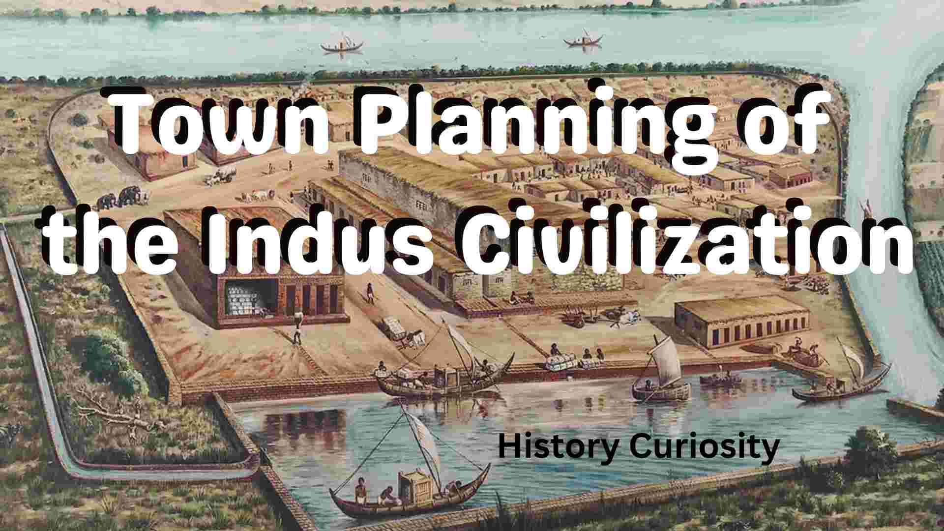
Town Planning of the Indus Civilization
| Historical Topic | Town Planning of the Indus Civilization |
| Largest Building | Great Granary |
| Big Bath | Mohenjo Daro |
| Streets | 9 to 34 feet wide |
| Elaborate gates | Surkotada, Dholavira |
| Citadel | Ruler Class |
Introduction Spatial planning of the Indus civilization
The most distinctive feature of the Indus Valley civilization is its spatial planning and hygiene. The basic arrangement of large Harappan cities and towns shows a regular orientation. Streets and lanes are laid out according to a set plan: a main street running from north to south, and cross streets and lanes running at right angles to them.
(i) The Harappan cities were the creation of careful thought and planning, as evidenced by the striking regularity of subdivision, the successfully aligned streets, the orientation of all the main streets to the cardinal points, the correspondence of houses and public buildings with the orientation of thoroughfares, etc. The streets varied from 9 feet to 34 feet in width and sometimes ran straight for a distance of half a mile. They intersected at right angles and divided the city into square or rectangular blocks. Within this square or oblong space, a series of narrow streets crowded with houses intersect the area. In Mohenjodar, every lane had a public well, and most houses had their own well and bathroom. No building was allowed to encroach on a public road, as in Sumer.
(ii) Important towns and cities of Indus Civilization such as Mohenjo-Daro, Harappa, Kalibangan, Dholavira, and Surkotada were divided into two parts: fortified settlements on high hills designated as ‘citadels’ and the main residential areas to the west of them called the ‘lower city’. At Harappa, Mohenjodar, Kalibangan, and Surkotada, there was a “citadel”, smaller in area than the “lower city,” and always located to the west of it. The citadel at Mohenjo Daro contained many impressive buildings, all made of kiln-fired bricks, such as a large bathhouse, a dormitory, a granary, and an assembly hall.
(iii) Harappa was considered to be another ‘capital’ of the Indus Empire. Here, to the north of the citadel, were the workers’ quarters, their work platforms, and the granary; the whole complex suggests a high degree of channeling of the working population.
(iv) Kalibangan, located on the left bank of the dried-up river (Ghaggar) Saraswati in Rajasthan, reveals the same pattern of planning as Mohenjodaro and Harappa, with a ‘citadel’ on the western side and a ‘lower city’ on the east. Thus, the citadel complex consisted of two equal and well-defined parts, one in the south containing several large adobe platforms for specific purposes, and the other in the north containing residential buildings. The platforms were separated both from each other and from the castle wall. There were regular passages around them. The entire complex on this platform—the well, bathing walkways, and clay-lined “fire altars”—had a ritual purpose. Another platform also suggests the same, on the top of which there was a well, the so-called “fire altar,” and a rectangular pit made of burnt bricks, containing the antlers and bones of cattle, which seemed to indicate a sacrifice.
(v) The lower town at Kalibangan, although showing the usual grid pattern of main thoroughfares, side streets, cross streets, and lanes, revealed that it was also fortified. The castle wall, which was built of mud bricks, was crossed by at least two gates, one on the north side leading to the river and the other on the west giving access to the citadel. In terms of width, the lanes and streets in Kalibangan followed a set ratio: so while the lanes were 1.8 m wide, the streets, in multiples of the first, were 3.6, 5.4, and 7.2 m wide.
(vi) At Surkotada, the settlement patterns of Harappa, Mohenjo-daro, and Kalibangan is repeated, but with a difference. The citadel and the lower city were connected, although their relative directional positions remained the same, the former to the west and the latter to the east. As in Kalibangan, the citadel and the lower town were fortified. Each had its own separate entrance, located on the south side; there was also a connecting gate between them. In addition to mud bricks, stone rubble, which is easily available in the neighborhood, was widely used for construction.
(vii) In the recently excavated Harappan city of Dholavira, there were three main divisions instead of the usual two at other sites. The first two parts—the “citadel” and the “middle”town”—were fortified with stone masonry. The whole plan resembles a European castle with two well-fortified areas. The fortifications were provided with bastions at frequent intervals and also gates, narrow or wide.
(viii) Banawali (Haryana) was another fortified city of the Harappan civilization. Although the general principles of Harappan urbanism were followed here too, there were significant deviations from the established norms. The city lacked a general concept of a checkerboard or grid pattern of planning. The roads here are not always straight, nor do they necessarily intersect at right angles, and systematic drainage is the exception rather than the rule.
(ix) Finally, the general division of a metropolitan or urban district into two distinctly separate walled institutions does not apply in Banawali. However, the available evidence demonstrates that there is a basic uniformity in the planning of most Harappan towns, including Banawali, regardless of their spatial dimensions. Another significant aspect of Harappan town planning was the provision of segregated houses, a modern feature. The lower town was populated by merchants, artisans, and craftsmen, while the priestly and ruling classes occupied the citadel.
Harappan Gates
Most of the large Harappan cities described earlier were surrounded by elaborately designed walls with gates. The Indus cities had no general system of city fortifications, which were often massive, as at Kalibangan, but gates were simple entry points into the cities. In Surkotada, Dholavir, these gates were quite laboratory-like, while in other cities they were very simple. Some gates had guard rooms attached, which were always very small. Harappan fortifications were not supposed to defend the towns from strong enemy attacks but were a security measure against robbers and cattle raiders. Fortifications also provided protection against floods and served as a sign of social authority over the territory they commanded.
Drainage system
An elaborate drainage system is a unique feature of the Indus Valley Civilization, the like of which has not yet been found in any other city of the same antiquity. Under the main streets and many alleys ran a main drain, 1 to 2 feet deep, covered with brick or stone, and provided with sumps and check traps at regular intervals. Individual house drains, each with its own sump, opened into street sewers, which opened into large culverts opening into the river. All sumps and drains were occasionally cleaned by workers, and the drains were provided with manholes for cleaning at intervals. This elaborate drainage system, as well as the urbanism, represents a marked difference from Sumer, where the inhabitants in most cases had vertical drainage shafts made of pottery under their yards but no drain. Overall, the extent of the sewerage system and the quality of the house baths and drains are remarkable, and together they give the city its own character, especially indicative of a highly efficient municipal authority. These features of urbanization and urbanism are further reflected in the overall layout and architecture of Harappan cities and towns.
Street
The Indus cities were built according to pre-arranged plans, as can be seen in the case of Mohenjodaro, which is very well preserved. There was a kind of municipal or civic authority that directed the development of the city. The streets ran in straight lines and crossed each other at right angles. Streets were aligned from east to west or north to south. The most famous street called “First Street” in Mohenjodar was 10.5 m wide and would have accommodated seven lanes of bicycle traffic at the same time. Other roads were 3.6 to 4 m wide, while lanes were 1.2 m (4 ft) up. The streets and alleys were not paved and must have been full of dirt and dust. However, “First Street” was covered with broken bricks and shards.
Bricks
Harappa, Mohenjo-daro, and other large cities were built entirely of bricks. All the bricks, fired or unfired, were well proportioned. Sun-dried bricks were used chiefly as fillings at Mohenjodaro, but at Harappa, it of course occasionally alternated with burnt bricks, and at Kalibangan, it was, if anything, more common, burnt bricks being almost exclusively reserved for wells, drains, and bathrooms. The prevailing brick size was 7 x 14 x 7, which is a ratio of 1:2:4. Very large bricks of 51 cm and more were used to cover the drains. The bricks were made from alluvial soil (i.e., deposits of soil left by floods) and shaped in an open frame form. Dredging and frogging were still unknown. Brick kilns have been discovered at a number of sites, and some of them were probably associated with copper processing. Sometimes the bricks were stored in large piles with a wood fire between them. The outside of the pile was covered with mud plaster to retain heat. The bricks were well-baked to a light red color. Wedge bricks were used for lining the wells, and small bricks (5 x 11 x 24 cm) were used to waterproof the bathroom tiles. A kind of brick dust and lime plaster were reported in some bathrooms. L-shaped bricks were preferred for the corners. Later, residents sometimes removed bricks from old houses and reused them. This was possible due to the non-sticky nature of the mud.
Great bath
The most important building in Mohenjodar was the great bath. Excavations show that the great bath was a large rectangular tank inside the city. Burnt bricks were used to make the floor of the large bath. Like modern swimming pools, they were used for special rituals and ceremonial baths. It was covered with plaster to prevent water from leaking out of the tank. There were steps on both sides of the tank. There was a substantial drain that was used to drain the water. Near the large bath were rooms that served as dressing rooms.
A large granary
One of the largest granaries was found in the Indus Valley at Mohenjo Daro. Almost every site excavated bears witness to a granary or storage system. Most staple foods, such as rice, wheat, and barley, were stored in these warehouses for public distribution during the calamities. The granaries in the cervical region were huge structures. Archaeological evidence suggests that the lower part of the warehouse was made of blocks, and the upper part was probably made of wood.
Buildings
The buildings discovered in the Harappan cities fall into three main classes:
- (i) residential houses,
- (ii) larger buildings,
- (iii) public baths, granaries, etc.
There are big differences in the size of residential houses. The smallest have no more than two rooms, while the largest are so vast that they almost look like palaces. The buildings were mostly plain, without any concessions or plastering. Decorative bricks were used only on the floor of one house in Kalibangan. The porches were probably decorated with wooden screws, which have now disappeared. The ground floor of the small house had dimensions of 8 x 9 m, and the large one was twice as large. The houses were spaced about a foot apart, probably to avoid a dispute with a neighbor, and the space between them was walled off at either end to prevent thieves from scratching the walls. The walls were very thick, indicating that some of the houses were two stories high. The square holes in the walls remind us that the upper floors and the roof rested on wooden beams. The roofs were made of reed mats and then covered with a thick coating of mud. The mat was tied to the wooden beams with cords; some cord marks are still visible. Undoubtedly, a few staircases made of fired bricks have been discovered, but as a rule, wooden staircases were used, which have mostly disappeared. Stairs had tall, narrow steps, sometimes 38 cm high and 13 cm wide, to save space. The roofs were flat and surrounded by a parapet. Ceramic gutters were made to drain rainwater; a number of them were found in Chanhudaro. No roof tiles have been found yet.
Houses were usually entered from the street. The houses were quite spacious, divided into large rooms with wells and bathrooms, and provided with covered sewage drains. An open courtyard was a fundamental feature of house planning in the Indus Valley, as it was in Babylon. The courtyard, which was usually paved with flat-laid bricks, was surrounded by chambers and had doors and windows opening into it. The kitchen was located in a sheltered corner of the yard, and the ground floor contained storerooms, well chambers, baths, etc.
Doors, windows and stairs
The doors were possibly wooden and were placed at the ends of the walls, not in the middle. Ordinary houses very rarely had windows in the outer walls. It is possible that the perforated gratings were used as windows or ventilators in the upper part of the wall. Stairs made of solid masonry can be found in almost every house. They were built straight and steep, with unusually narrow and high treads. In some cases, the staircase led to the upper floors. bath, and living and sleeping apartments.
Kitchen
The kitchen was small. The fuel was placed on a raised platform. Cooking was mostly done in open-air courtyards. A round bread oven was discovered in which “tandoori rotis” were made. Sometimes a “serving hatch” (an opening in the wall) was created between the kitchen and the larger room, and pottery vessels were sunk into the kitchen with a hole in the bottom for wastewater. The water gradually flowed into the ground.
Bathroom and toilet
Each house had its own bathroom, which was on the street side. Latrines, although rarely found, lay between the bathroom and the street for convenient water disposal. Bathrooms and latrines on the first floor had brick channels. The walls of the bathroom (usually a small square room) were lined with bricks laid on edge so that they stood three inches above the level of the floor. It had brick paving sloping to one corner. Potter’s rasps were used to remove the thickened cuticle. Pottery pipes were used for drainage, each fitted with a neck to fit together.
College
Several residential houses, both large and small, have been discovered at Mohenjodar. There were large khans (inns), warehouses, and watch towers. To the west of the stupa is a vast building measuring 69 x 23.5 m. It was a priestly society. It contains the Great Baths excavated by Sir John Marshall. The entire complex forms one architectural unit, with walls sometimes 1.2 m thick. It could have been a college, hence the name ‘collegiate building’.
auditorium
A hall, 8 m2, with a roof of 20 rectangular brick pillars in four rows of five pillars, was discovered to the south of the stupa at Mohenjo Daro. There are four well-paved lanes separated by rows of pillars. The hall was used for some religious gatherings. Sir John Marshall compares it to a Buddhist rock temple of a later date, while Mackay calls it a large marketplace with rows of permanent stalls along the lanes.
Warehouse
A building measuring 50 by 40 meters with a central passage 7 meters wide was discovered at Harappa. It was a huge warehouse of grain, cotton, and other goods. Some buildings were used as boarding houses; they had depressions on the floor that contained large ceramic vessels for liquids, grains, and other foodstuffs.
Palace
A short distance from “First Street” in Mohenjodar stood a magnificent building of excellent masonry. It has two spacious courtyards, servants’ quarters, and storerooms. It was either a temple or a governor’s residence.
Population
The number of inhabitants of the city gradually increased, and large houses were divided into smaller ones. In later stages, civil rules were not strictly followed. The entire city was protected by a “city wall”. A small fort has been uncovered in the most important cities.
Although it is difficult to estimate the population of Harappan cities, Lambrick gave a figure of 35,000 for Mohenjodar based on a comparison with the city population of a comparable area in Sind in 1841. Another estimate by Fairservice suggests a slightly higher figure of 41,000. He also suggested a figure of 23,000 for the lower city in Harappa, with the exception of the citadel. According to Allchins, the population of Harappa may have been more or less the same as that of Mohenjo-daro, as both were the same size. S. R. Rao estimated the population of Lothal at around 15,000, while according to S. P. Gupta, Lothal must not have accommodated more than 2,000 to 3,000 people during its peak.
Foundation deposits
It was commonly believed that the Harappans did not use endowment deposits, a system prevalent in Babylonia and Egypt. Such deposits help the excavator fix the date or history of the building. However, in Kot Diji and Allah Dino, stone foundations were discovered. However, nothing is known about the ceremonies associated with laying the foundation.
Articles for the household
A variety of household items have been found at Harappan sites. These were made of pottery, stone, shell, earthenware, ivory, and metal. Copper and bronze appear to have replaced stone as a material for domestic tools. Pottery clay supplied numerous items to the kitchen, including meat rubbers, cake tins, ladles, beakers, bowls, cups, bowls, pans, saucers, ladles, warmers, glass stands, storage containers, etc. Pointed bottom cups were the usual vessels for drinks that had only been used once. Stone objects include querns, palettes, and glass stands. Covers for glasses and ladles were also made from shells. There were needles, awls, axes, saws, sickles, knives, fish hooks, chisels, etc., of bronze or copper; the first two were also of ivory. Blocks of lead were probably used as network platinum.
Conclusion
The Indus Valley Civilization was among the oldest and most developed societies. The urban planning system of the Indus Valley Civilization has impressed many archaeologists. They systematically planned their residential houses, public buildings, and streets and had proper drainage systems. All houses were well connected to the road drainage. The gutters were covered with wooden or stone slabs, indicating that they knew about the pollution of the water. People followed an excellent pattern of building houses and buildings. The Indus Valley Civilization lived a well-developed life.
Videos about Town Planning of the Indus Civilization
(FAQ) Questions and Answers about Town Planning of the Indus Civilization
Q-1. What was the arrangement of cities in the Indus Valley?
Ans. Indus Valley cities had a well-planned grid layout with streets running in a perpendicular pattern, dividing the cities into organized blocks.
Q-2. What were the key features of their spatial planning?
Ans. Indus Civilization’s urban planning included advanced drainage systems, well-organized streets, and standardized brick sizes, indicating a high level of urban planning.
Q-3. Did they have any public buildings?
Ans. Yes, Indus cities featured public structures such as granaries, baths, and perhaps religious or administrative buildings, demonstrating a sophisticated understanding of urban architecture.
Q-4. How did the Indus people manage sanitation?
Ans. The Indus people had an advanced sanitation system with well-constructed drainage channels and public and private bathrooms in households, indicating a focus on sanitation and urban planning.
Q-5. Were there any citadels in the Indus cities?
Ans. Some Indus cities, such as Mohenjo-Daro and Harappa, had citadels, elevated areas with possibly administrative or religious significance, suggesting hierarchical organization within these urban centers.
Q-6. What is unique about urban planning in the Indus Valley compared to other ancient civilizations?
Ans. The urban planning of the Indus Valley stands out for its advanced sewerage and drainage systems, grid-based layout, and absence of pronounced social hierarchies in residential areas, setting it apart from some contemporary civilizations.